
As our social media posts are going to be very limited following recent changes by Meta, we’re instead going to update you much more regularly here on what we’ve been up to with recent work on Walkhighlands from behind the scenes.
Route updates
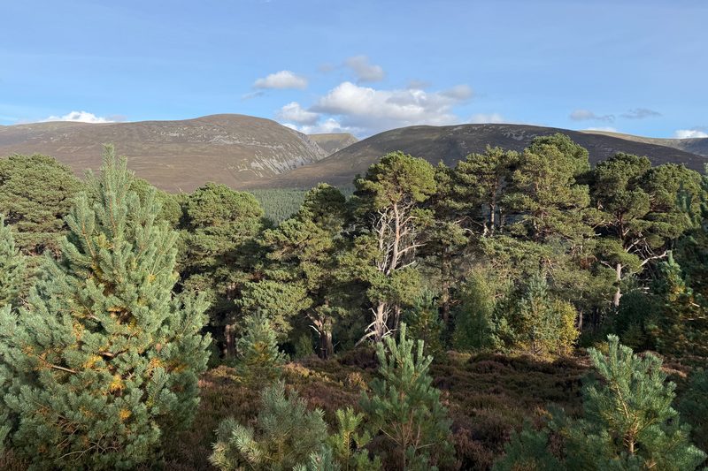
Whilst we have a long-running program of updating our oldest routes, we also respond to the constant updates we are very kindly sent by users – and the fact is that some parts of Scotland change constantly whilst others barely need updates at all. One example of the former is the Corbett Carn Dearg Mor on the west side of lovely Glen Feshie. Over recent years the old plantations on the southern slopes of this hill have been felled, many of the tracks shown on OS maps restored back to moorland, and the open slopes have been planted with native trees. Whilst these are great strides forward for nature and landscape, the old route we had up the southern slopes of Carn Dearg Mor got harder and harder, and we’ve had a few people get in touch who found it too difficult. We rewalked this yesterday and have updated it this morning, to use the tracks leading further west – it adds 3km or so to an already epic day but does give better going underfoot. And it’s always a pleasure to have an excuse to revisit Glen Feshie!
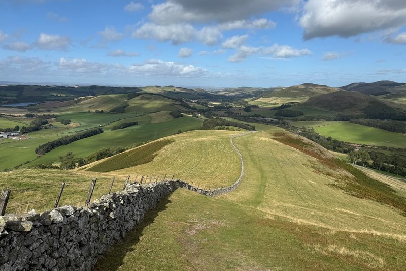
Other routes updated over the last couple of weeks include the Gorebridge and Temple circuit, which has been rerouted to avoid an overgrown problematic stretch. Another set of fallen trees has now been cleared on the Lochalsh Dirty 30. We’ve rewalked and updated the Glen Brown circuit near Tomintoul, which has had a section of path rerouted to avoid pastures. We’ve had extensive feedback from Cramond Walkers, helping us to update Dalkeith Country Park, and the Lowther Hills amongst other routes. Our biggest set of updates in September though was for St Cuthbert’s Way, which is a really superb long distance route – we rewalked and have rewritten our entire route guide.
Technical changes
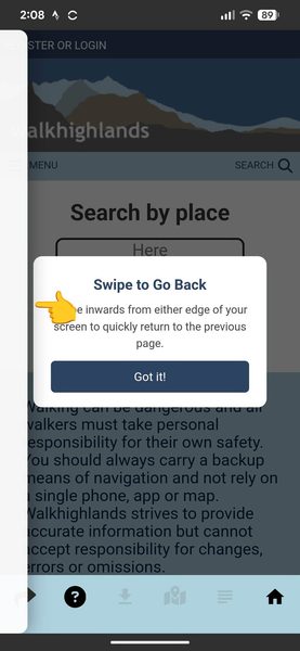
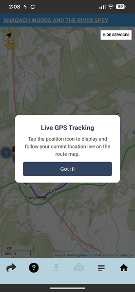
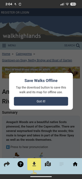
It’s been quite a busy month on the coding side of Walkhighlands. The biggest update so for to our app has been completed and is now out in the Google Play and Apple App Stores. Since the app launched in the early summer, we’ve heard from alot of people who didn’t understand important features – such as the need to download walks in order to use them offline, how to go back in the app by swiping from the left, or that you could show your current position on the map using the locate button. So we’ve now added a series of wee tutorials that show up as you first navigate around the app – including one pointing out where the Help button is!
From early next year, Android has a new requirement that when a user migrates to a new phone, apps need to transfer your login across automatically, otherwise your app will be dropped from the store. To support this we’ve had to rewrite the way the app keeps you logged in, but it also means you won’t get logged out in our app now even if your phone deletes the cookies. The update also includes a fix to the Android version where a very small number of users had a corrupted database preventing them from downloading walks unless they manually cleared their storage. The messages that the app shows when it is loading a page from the internet etc. have been made clearer too.
On our forums, we’ve fixed a couple of long-standing annoyances. When you have a post with lots of photos, if you delete one of them (say Photo 3), the others shuffle up into the spaces (e.g. Photo 4 then becomes Photo 3, etc). This is a standard feature of the forum software, but by request we’ve now rewritten the way our walk reports work so that if you delete a photo then it doesn’t affect the ordering of any other photos you’ve already placed in the text. We’ve also fixed what was referred to as ‘ghost posts’ – if a user posted publicly to the forum and then made the post private, the index page of the forums would still say there was a new post (which was no longer there if you clicked through) – hopefully this is now resolved.
Access issues
Every week we hear of new access issues affecting our routes; the worst ones usually need to be reported to the relevant Council Access Officer by the person finding the issue, but sometimes we can make adjustments together with the landowner that suit everyone. We had a great result from Highland Council, one of the most responsive authorities on access problems, who quickly resolved the issue of a locked gate on the Raasay Ironstone Mines route. They are currently looking into another locked gate in a new deer fence barring the usual route up Sgùrr a’ Choire-bheithe in Knoydart. We’ve also reported fallen trees blocking a core path near Temple in Midlothian, and have been dealing with issues on Wyre in Orkney. The reopening of the slate quarry on Luing has led to the loss of the walk around the coastline – we’re looking at rerouting that one. This month is also the start of the busiest period for stag stalking – we’ve put all the latest info from the stalking estates up on relevant walk routes, where available in conjunction with NatureScot.
As you have probably read elsewhere, we’re supporting Ramblers campaign for access to the Carn Mairg group of Munros above Glen Lyon to be brought inline with the Scottish Outdoor Access Code and good practice by stalking estates in other parts of Scotland.