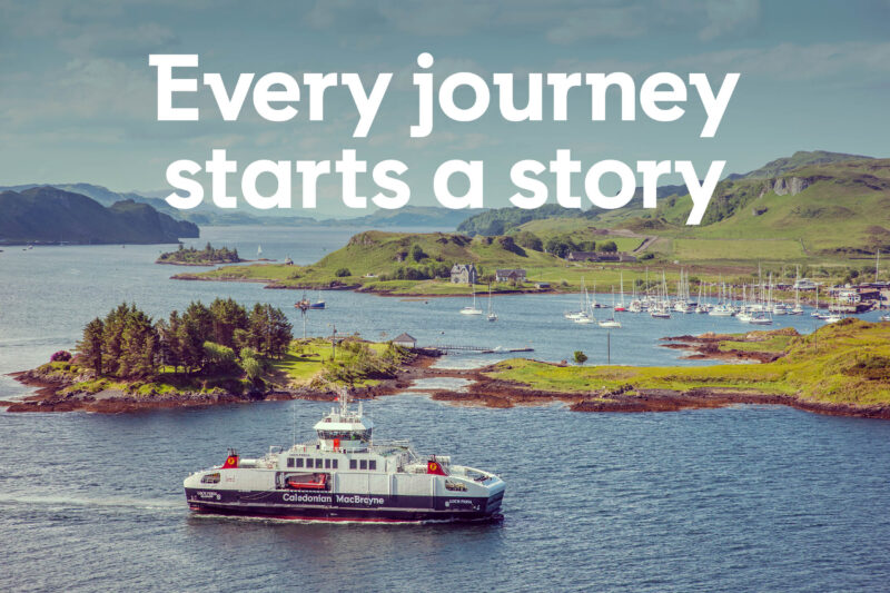
Every journey starts a story
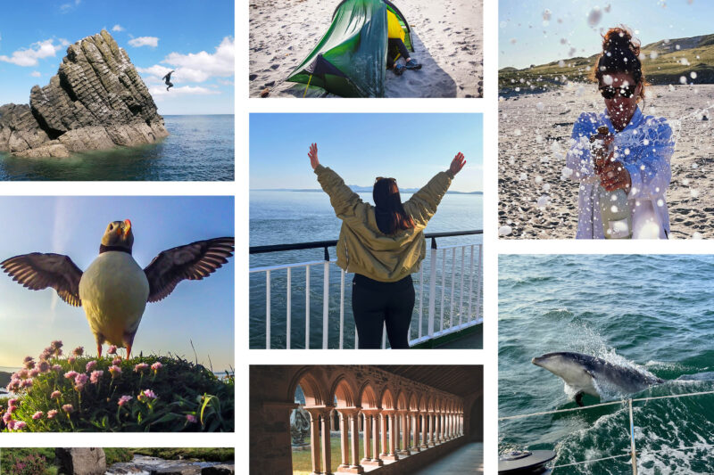
Every visit to one of Scotland’s islands is a true adventure. The Hebrides are renowned for some of the most spectacular coastal and mountain landscapes in Europe. Imagine standing on a rugged coastline, overlooking a vast sandy beach, the wind rich with the scent of the abundant machair flowers. Where could be a better place to explore on foot?
Whether you’re taking in the panoramic views from the hilltops, striding out across the sands or pausing to watch an otter catch fish, the island’s natural beauty will capture your heart. You’ll uncover endless layers of human history here too, from ancient prehistoric remains, through the harshness of the Highland Clearances, right through to the richness of today’s vibrant island culture.
In this article, sponsored by Scotland’s Clyde and Hebridean ferry operator Caledonian MacBrayne (CalMac), we pick 10 of our own favourite walks from the islands off Scotland’s west coast. CalMac is the UK’s largest ferry operator, running 29 routes to more than 50 destinations over 200 miles of Scotland’s west coast.
Create your own unforgettable story on Scotland’s west coast isles. CalMac makes it easy to discover Scotland’s west coast islands by ferry, offering everything from high-energy adventures to relaxing escapes and delicious local food. From Arran and Islay, to Mull, Skye, and Barra, you’re sure to come back with a tale to tell. To ensure a smooth sailing, book online before you go and download the CalMac app for updates on route services.
Are you ready to step on board and lace up your boots?
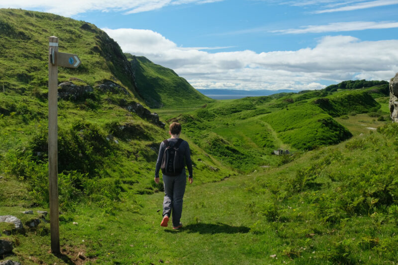
The Three Beinns, Isle of Arran
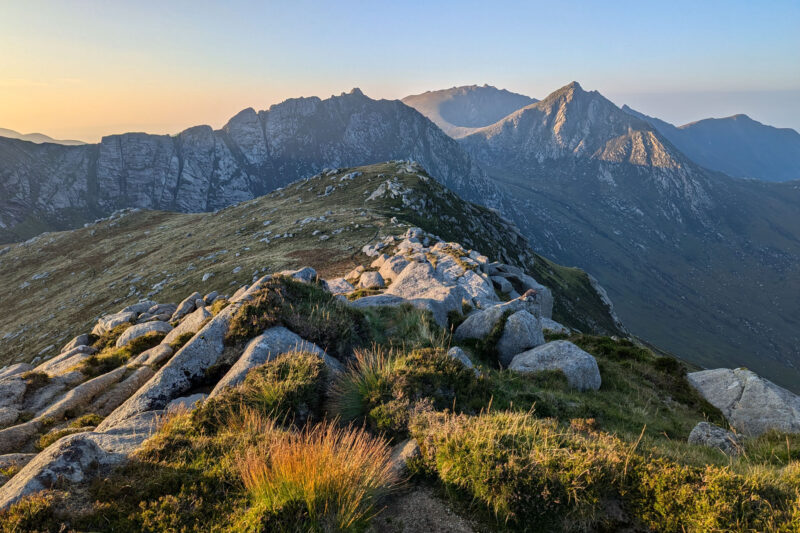
The walk
Arran offers walkers an incredible variety of landscapes, from coastal paths and forests to its rugged granite mountains. Whilst Goatfell is the highest and most popular peak, just across Glen Rosa is this more challenging mountain horseshoe taking in three summits. There are spectacular views of both mountain and sea throughout.
Getting to Arran
The main CalMac ferry services are from Ardrossan and Troon in Ayrshire, sailing to Arran’s capital, Brodick. There is an additional service linking Lochranza in the north with the Kintyre peninsula.
Heaval, Isle of Barra
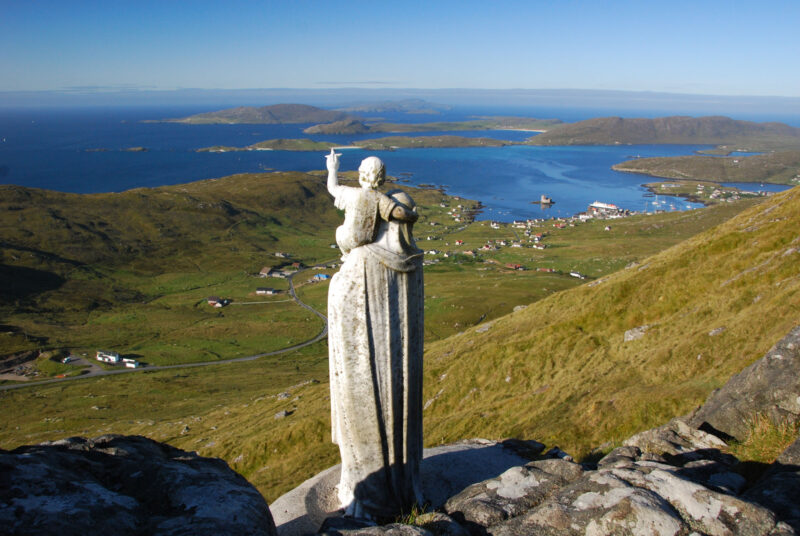
The walk
Barra and its neighbour Vatersay are the most southerly main inhabited islands amongst the Outer Hebrides. These are historically predominately Catholic islands, and this becomes very clear on the short but steep ascent of Heaval, the island’s highest peak, topped by a white statue of the Virgin and Child overlooking Castlebay.
Getting to Barra
Barra is served direct by the CalMac ferry service from Oban, a crossing of just under 5 hours. There is also a linking ferry service from Barra to Eriskay, the next island to the north in the Western Isles archipelago.
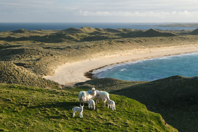
Isle of Berneray Explorer
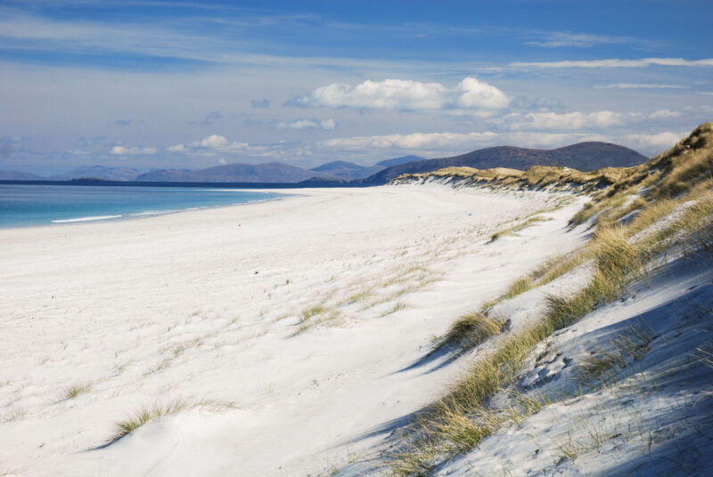
The walk
Berneray is one of the lesser known of the Western Isles, but must also rank amongst the most beautiful. Much of the island is explored by this excellent and very varied walk, taking in the views from its highest hill, a standing stone, the picturesque thatched hostel, and one of the most magnificent beaches in the UK.
Getting to Berneray
Berneray is linked to neighbouring North Uist by a causeway, and North Uist has a CalMac ferry service from Uig on Skye. For those visiting more of the Western Isles, Berneray also has its own CalMac route linking to Lochmaddy on Harris to the north.
Kilchattan Bay circular, Isle of Bute
The walk
Bute first became a popular holiday resort in the days of the Clyde steamers. The boats brought thousands from the grime of the city to beautifully-built, elegant resorts such as Rothesay, its fine capital. This route explores the southern end of the island, visiting an atmospheric ruined chapel as well as some superb coastal scenery; it is also the first stage of a multi-day hike known as the West Island Way.
Getting to Bute
Bute is within easy reach of Glasgow; the main CalMac ferry leaves from Wemyss Bay, taking 35 minutes to reach Rothesay. There’s also an even shorter ferry that links Rhubodach at the northern end of the island with Colintraive on the Cowal peninsula.
Calgary Point, Feall and Crossapol Bays, Isle of Coll
The walk
Although it rises to only 104m, Coll is a very rugged island, contrasting with the flatter green fields of nearby Tiree. The population of less than 200 mostly live in and around the tiny capital Arinagour, giving much of Coll a very remote feel. Stride out on this exploration of the western end of the island, visiting a pair of incredible beaches. Listen for the distinctive ‘crek-crek’ call of the Corncrake, once widespread but now one of Britain’s rarest birds.
Getting to Coll
Coll is served by the same CalMac services as its neighbour, Tiree. It runs from Oban on the mainland, and makes it easy to enjoy both islands on a single multi-day trip.
Tarbert to Seilebost, Isle of Harris
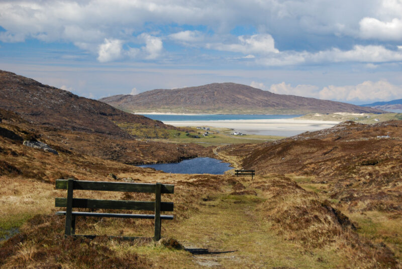
The walk
This linear walk is part of the Harris Walkway that opened in 2001; more recently it became a part of the Hebridean Way. If you time it to catch a bus back from the end to Tarbert it makes for a superb day walk. Follow a variety of old paths passing the tiny bays, wide seas and barren moors of the Bays district before following an old coffin route over a low bealach to reach the machair at Seilebost, overlooking the iconic Luskentyre sands.
Getting to Harris
Harris can be reached directly by CalMac ferry from Uig on Skye to Tarbert. For those visiting several islands, you can also reach it from Lewis to the north (having used the ferry from Ullapool to Stornoway), or from Berneray to the south (ferry from Berneray to Lochmaddy). Berneray is linked to North Uist by a road causeway.
Mull of Oa and the American Monument, Isle of Islay
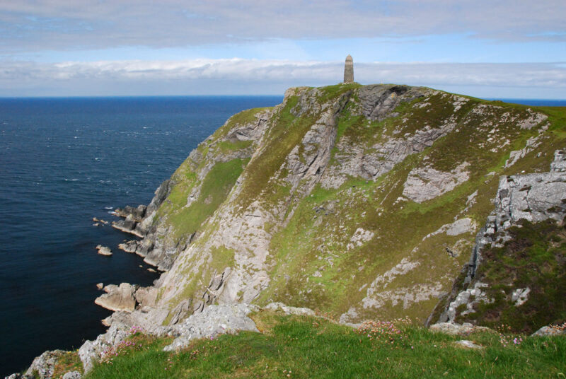
The walk
The Mull of Oa is one of the most dramatic locations on Islay – the furthest point of the rugged, cliff-girt Oa peninsula. It is crowned by the 131m high American Monument, a moving memorial to the men who lost their lives in two shipwrecks off Islay in 1918. This straightforward route is waymarked and lies within an RSPB reserve so is a great spot for wildlife watching.
Getting to Islay
Islay has two main ferry ports, Port Ellen and Port Askaig, both of which are linked by CalMac ferry to Kennacraig on the Kintyre peninsula. Port Askaig also has ferry connections to the islands of Colonsay and neighbouring Jura.
Butt of Lewis circuit, Isle of Lewis
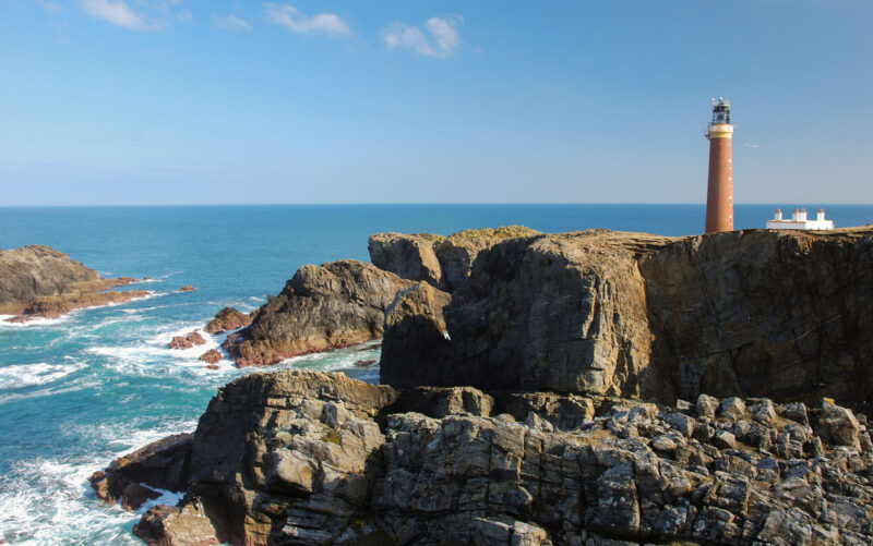
The walk
The Butt of Lewis is the dramatic northern extremity of Lewis, the tower of its slender brick lighthouse standing proud against the storms that often rage here – a spot often claimed to be the windiest in Britain. This superb circular walk takes in the cliff-top scenery as well as the stunning Eoropie beach – it can easily be extended if you wish to take in the bridge to the historic stack of Dun Eistean.
Getting to Lewis
The largest of the Hebrides (together with Harris with which it forms a single landmass) can be reached directly using the CalMac ferry from Ullapool to its capital, Stornoway. Alternatively there is a shorter ferry crossing from Uig on Skye to Tarbert on Harris, linked to Lewis by road.
Tobermory Lighthouse circuit, Mull
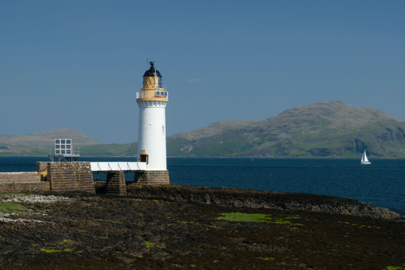
The walk
The multi-coloured houses around Tobermory harbour are perhaps the most iconic image of the Isle of Mull. Few visitors, however, head out from the harbour on foot to follow this excellent path through the woods out to the picturesque lighthouse at Rubha nan Gall. There are great views over the water to Ardnamurchan – look out for seals, dolphins and porpoises. You can either return the same way, or via a rougher, steeper route that runs higher along the hillside for wider views before skirting the golf course to return to Tobermory.
Getting to Mull
The main route to Mull is the CalMac ferry route from Oban to Craignure in the southeastern corner of the island. There is also a much shorter crossing to Fishnish from Lochaline on the Morvern peninsula, which is more convenient for those approaching from further north. There’s also a summer service direct from Tobermory to Kilchoan, on the Ardnamurchan peninsula.
The Mausoleum at Harris, Isle of Rum
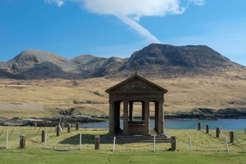
The walk
Rum is the largest of the Small Isles. Magnificently wild and rugged, it is dominated by the towering mountains of the Rum Cuillin – a miniature version of the alpine peaks of Skye. The island was owned and run for many years as a private hunting reserve by the Bulloughs – wealthy Victorian industrialists from Yorkshire. Since 1957 the island has been managed as a state-owned reserve with a long term study of the deer being undertaken. A more recent community buyout means the area around Kinloch Village is now owned by locals with the remaining land owned by NatureScot. This walk heads across the island to visit the Bullough’s mausoleum at Harris on the west coast – an incongruous reminder of the island’s past.
Getting to Rum
Rum is reached using CalMac’s Small Isles ferry service that sails from Mallaig and offers links with Eigg, Canna and Muck on different days. Note that visitors cars are not permitted on this service, but you can take bikes and kayaks.
Every journey starts a story, start yours today at calmac.co.uk
Share your adventures. Tag @walkhighlands, @calmacferries and #StartYourStory