
Summary
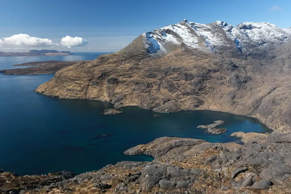
Diminutive Sgùrr Na Strì may be reach 494 metres in height, but it's proof that - when it comes to mountains - size doesn't matter. Reaching it requires a long and quite rugged walk, but the rewards are immense. Many walkers reckon that the view from the summit - over Loch Coruisk, the Cuillin and the sea - is the finest in all Britain.
Grade

Bog Factor

Rating
Distance
Time
(in summer)
Ascent
Terrain
Clear footpath for most of the walk, but the final ascent to Sgùrr na Strì is rough, rocky and pathless and requires careful route-finding.
Are you REALLY ready for winter hills?
Hillwalking when there is snow lying requires an ice-axe, crampons and knowledge of how to use them safely. The description here is for summer conditions.
See our Winter Skills page for basic information on the essential skills, techniques and knowledge needed for winter.
Getting there
Start
Car park off the road on east side of river at Sligachan.
Public Transport
Buses from Portree, Broadford and Kyleakin - get off at Sligachan Hotel.
Start Grid Ref
NG487298

Stage 1
Start on the south side of the river at Sligachan i.e. the opposite side to the hotel, where there is a carpark. Take the track down towards the old bridge over the Sligachan river, but before reaching it turn left through a gate and follow the path to reach the statue commemorating Prof. Norman Collie and local guide John McKenzie - pioneers in the early exploration of the Cuillin peaks. Keep on the path to the left of the statue, soon running alongside a fence. After 200m ignore the gate in the fence and instead continue on the footpath up Glen Sligachan.

Stage 2
There are fine views of Sgùrr nan Gillean to the right, and the Red Hills and then Marsco to the left. The path crosses numerous small streams, and after 3 kilometres reaches a larger one - the Allt na Measarroch. Cross this on large stones. After another boggy section, the path becomes drier. After several more kilometers there are views up Harta Corrie to Sgùrr Dubh Mòr, Sgùrr Alasdair and the In Pinn (the Inaccessible Pinnacle - technically the hardest Munro), seen over the Lochan Dubha.

Stage 3
The almost imperceptible watershed is crossed, and shortly after this, the path forks at a large cairn. Take the right fork which soon crosses a stream. Blà Bheinn (Blaven) dominates the view from here, its great western face looking unclimbable. The path begins to climb the ridge on the right side of the valley, climbing to a shoulder with a tiny lochan. The prominent pyramidal peak ahead is not Sgùrr na Strì as might be hoped, but is Sgùrr Hain.

Stage 4
Eventually the Druim Hain ridge is reached at a large cairn. The view from here is tremendous; the lower part of Loch Coruisk is visible below; further right, Sgùrr nan Gillean is a slender spire supported by its upper two pinnacles. The path forks at the cairn; the right hand branch descends to Loch Coruisk; take the left branch instead, which contours the slopes below Sgùrr Hain. Continue on this rough path, which descends slightly, for some distance.

Stage 5
The path peters out almost completely at the foot of Sgùrr na Strì. From here, you can either head up briefly by the burn before bearing right, or head up the easy angled broad ridge to the right of the burn, slabby with gabbro. Whichever exact route is taken, the well-built cairn on the western summit should eventually be reached. Sgùrr na Strì (meaning the peak of Strife) may be only 494 metres high, but on a clear day you couldn't get closer to heaven. The seaward vista takes in Eigg and Rum, and Mull beyond, but it is the view of the Cuillin Ridge curling round Loch Coruisk which is, quite simply, magnificent. From Gars-bheinn the ridge takes in Sgùrr nan Eag (set slightly back) and then Sgùrr Dubh Mòr , looking dominant from here with its great ridge sweeping down to Coruisk.

Stage 6
Sgùrr Alasdair is hidden behind it, but Sgùrr a' Ghreadaidh and Sgùrr a' Mhadaidh look fine at the back of Coruisk. Further right is Bidean Druim nam Ramh with its two summits, and Bruach na Frithe, before the distinctive Am Basteir and its tooth and finally the pinnacles of Sgùrr nan Gillean. It is also worth approaching close to the edge of the cliffs for a great view almost straight down towards the Bad Step and two beautiful sandy bays.

Stage 7
Note that the true highest point of Sgùrr na Strì is actually the eastern summit, 200m away across a deep gash. From here there is a spectacular view down to Camasunary bay and Loch na Creitheach backed by Blà Bheinn. It is possible with care to find a descent route towards Camasunary by heading north for a couple of kilometres along the ridge before looking for a way down.

Stage 8
However, for most walkers, the return to Sligachan by the route of ascent will be quite enough for one day. The long walk back is relieved by the spectacular surroundings, and the Sligachan hotel becomes visible as a white speck many long miles before it is finally reached.

Route Profile
