
Which is the hardest of the Munros? It’s a very subjective question – so this is always going to be a personal list. Those who struggle with scrambling or have a strong fear of heights are likely to regard the rockier and more technical mountains with trepidation. For others, fitness may be their limiting factor on days in the hills, and attempting the more remote mountains may require careful planning and the maximum of effort.
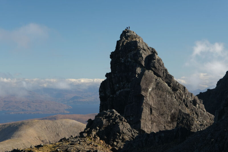
The Inaccessible Pinnacle
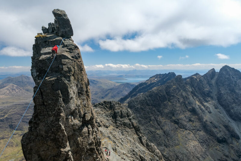
The name says it all really, doesn’t it? The Inaccessible Pinnacle (often abbreviated to the In Pinn) is mostly usually described as the hardest of the Munros. It is certainly the most technically difficult, as its ascent requires a rock climb (either ‘Moderate’ but exposed and hard to protect up the long side, or ‘Difficult’ but with less risk of a pendulum swing, climbing the short side); the descent is usually done by abseil. Many Munro baggers have to get the help of a guide or a rock-climbing friend to do this one. On the other hand, you can be up and down it in an 8km venture from Glen Brittle; it’s just not the simplest 5 mile walk out there!
A’ Mhaighdean
At the other end of the scale, A’ Mhaighdean has simple grassy slopes on its eastern side, but reaching the foot of those slopes is the problem! A’ Mhaighdean is usually reckoned as the most remote of the Munros, though it really shares this distinction with its neighbour, Ruadh Stac Mòr. Whether you climb it as part of the classic Fisherfield round (approached from Corrie Hallie near Dundonnell to the northeast), from Poolewe to the west, or from Kinlochewe to the southeast, getting here is a really epic outing across very rugged terrain. Most Munro-baggers will need at least one overnight stay in the wilds to get to this one.
An Sgarsoch and Càrn an Fhidhleir
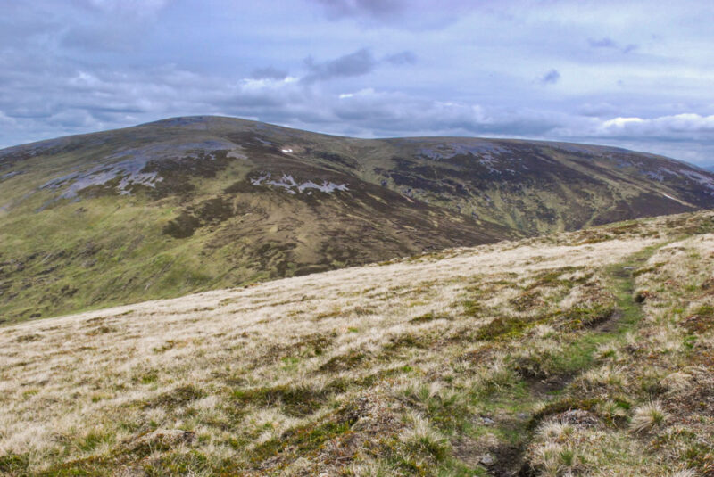
These two hardly ever get a mention, but – if you measure it as the crow flies from the nearest road – they are in fact the most remote peaks in Scotland. Càrn an Fhidhleir is over 14km in a straight line from Achlean in Glen Feshie, and An Sgarsoch only marginally less from the Linn of Dee (both beating Mullach na Dheiragain by a kilometre or so). So why have do so few rank them amongst the hardest Munros? Partly it may be due to their very rolling – some would say shapeless – character. But more probably it is because although the approaches are undoubtedly long, the terrain is mostly straightforward – and a mountain bike brings them in much closer range if tackled from Deeside. Don’t underestimate them though – the crossing of the Geldie Burn has foiled many when attempting that approach after rain.
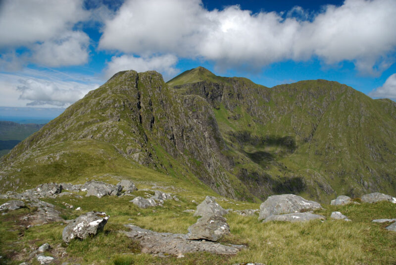
Aonach Eagach (Meall Dearg)
The Aonach Eagach ridge – linking the two Munros of Meall Dearg and Sgòrr nam Fiannaidh – is often claimed to be the narrowest ridge in mainland Scotland. The scramble along it is certainly tricky: at Grade 2-3, less confident scramblers often opt for the security of a rope and guide to make the traverse. What makes it harder than other ridges such as An Teallach, is that there’s no viable bypass path to avoid the hardest parts of the traverse – the ridge has to be tackled direct. Those nervous of heights do have alternate ways to bag the two Munro summits though – Sgòrr nam Fiannaidh can be ascended without scrambling by using the usual descent route to climb up – from the bealach with the Pap of Glencoe, whilst Meall Dearg can be reached without the use of hands using this route on the hidden northern side.
Am Basteir
There’s no debate than the In Pinn featured above is the most technical Munro; beyond that many of its peers on the Cuillin ridge vie for the runner-up spot. We think Am Basteir perhaps takes the second spot; the crux of this one for most baggers is the Bad Step, an awkward down-climb on the ridge just before the summit which became more difficult following storm damage a few years ago, and tips into rock climbing territory. Whilst there is a fairly precarious, loose and hard-to-find bypass – most sensibly opt to stick to the ridge and tackle the step – often using a rope for security. Beyond Am Basteir, we would put Sgurr nan Gillean and Sgùrr Mhic Chòinnich next, perhaps together with Sgùrr Dubh Mòr – the latter because the easiest line can be hard to find.
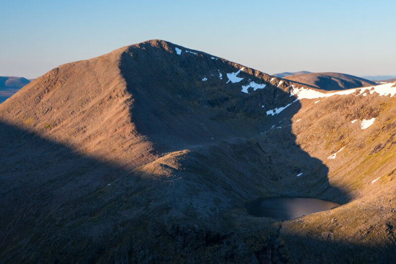
Beinn Mheadhoin
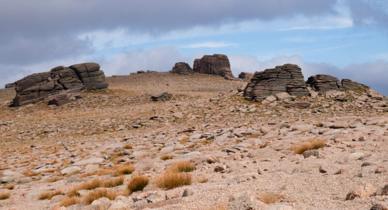
Hidden at the heart of the Cairngorms, Beinn Mheadhoin may not be the most well known mountain or the most obvious choice for inclusion on a list of the most difficult Munros. Although it’s only 5.5km from the ski centre car park as the crow flies, the fact that for its shortest route you have to climb to over 1100m on Cairn Gorm – and then descend right back down to Loch Avon at 725m before ascending again to its 1182m summit – means that Beinn Mheadhoin still ranks high in terms of physical effort to reach, especially as you’ll then have so much climbing once again on the way back out. But it actually has a wee bit of technical difficultly too – as a final sting in the tail, the highest point is atop one of its impressive granite tors – a short but definite scramble with one awkward step. There is an alternative approach from the Linn of Dee – but this is a long outing whatever the route.
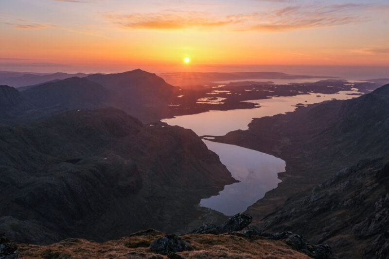
Ladhar Bheinn
Many people regard the Knoydart peninsula as the most remote part of the Scottish mainland – the community at Inverie (and its famed pub, the Old Forge) has no road links to the rest of Scotland. Ladhar Bheinn is the peninsula’s finest mountain and one of the grandest of all Munros. If you include the beautiful walk-in in along the shores of Loch Hourn to Barrisdale Bay then it certainly matches the effort required to reach the other remote peaks on this list – and there’s a bit of scrambling on its ridge too. However, for those who take a boat in to Inverie from Mallaig things are a little easier – whilst the full round is a major effort, you could head up and down the descent route via Folach to make things much easier (and completely avoid any use of the hands).
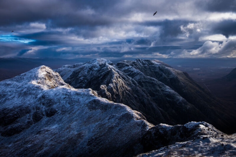
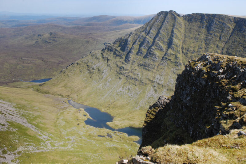
Liathach – Spidean a’ Choire Lèith
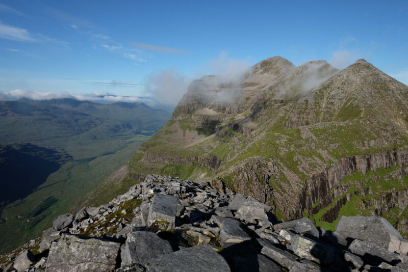
Few mountains look more impregnable than Liathach – perhaps the greatest of the celebrated Torridon mountain ridges, linking two Munros: Spidean a’ Choire Lèith and Mullach an Rathain. The linking ridge between them is a fine grade 2 scramble with exposed situations, and the ‘bypass’ path on the southern side is narrow, eroded and scarcely any less exposed. However, those wishing to avoid the ridge can have an easier time climbing the two peaks individually – though be warned, it’s still really steep! Spidean a’ Choire Lèith is the harder of the two as it has a little unavoidable scrambling en route.
Cairn Toul
The highest mountain on this list, Cairn Toul is the most remote of the UK’s 4000 foot summits. The fastest approach from Deeside involves a very long walk up either Glen Luibeg or Glen Dee to reach Corrour Bothy, followed by an ascent of the path up the steep headwall of Coire Odhar – which often holds snow into early summer. Most baggers will be looking to extend the route over neighbouring Sgòr an Lochain Uaine and probably completing the classic traverse round to Braeriach – in which case a Speyside start is probably easier, with a long walk back through the Lairig Ghru.
Seana Bhràigh
At 10km in a straight line from Inverlael, Seana Bhràigh is another very remote hill. Whilst that shortest approach is probably the most popular amongst hill-baggers, it is made a little more challenging in that the route is high and exposed for much of the distance – there’s no long low easy walk in on a track that you could cycle in on for this one. Unless, that is, you use the Strath Oykel approach – in which case a bike would be handy, but you are really in epic distance territory, though there are a couple of bothies to help out.
Looking for more Munros? Here are our picks of the easiest, the best, and the best multi-Munro days.